Instructor-led training that works
Find your perfect course
Popular searches include:


Service rating 134 Reviews
Excel yourself - Prepare yourself for the next level in your career.
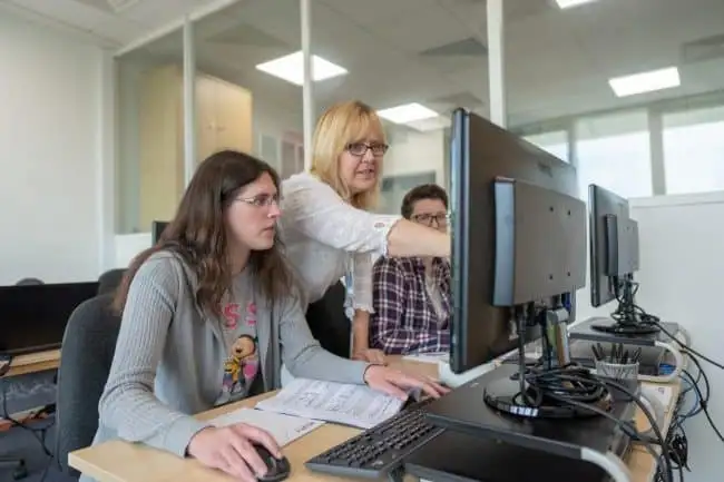
Acuity Training is a multi-award-winning training business offering in-person and online courses.
We run training courses for popular business software including Microsoft (Excel, Power BI, Project, SharePoint etc), Adobe, AutoCAD and SQL.
We also provide soft skills and management training (team leader, line management, time management etc).
Our small classes and expert, passionate instructors ensure you get plenty of personal attention and time for questions.
We have locations for in-person courses in London and Guildford or we can come to your site for private training.
Easy, convenient booking procedure
Learn from passionate, expert trainers

Award-winning 9 years in a row
Scheduled & custom courses
Small, personal classes (Average = 4)
The depth of knowledge that was discussed was really helpful.
Oliver Colegate, Business Operations Assistant, Starr Underwriting Agents LimitedThe steps were explained clearly, and we were able to cover a lot without rushing.
Maiken Van Der Veen, Aish Technologies Limited
Quinten Taylor, UCEM
Very professional instructor. I now feel like I can build my own power BI report.
Sara Santiago, Business Accounting, Grandvision Retail Holding B.V.Lisa Cushing, FC, Careers and Enterprise Company
The instructor was clearly very knowledgeable and extremely enthusiastic, and this was great to engage you in the training.
Danny Snowling, Senior Project Controls Engineer, 20/20 Business Insight LtdThe course leader explained everything very clearly, easy to understand.
William Dawe, Underwriting Operations Technician, Starr Underwriting Agents LimitedThe venue was fantastic and the refreshments were a nice touch. Trainer was very detailed and everything ran on time.
Mark Bennett, Fizz Experience LimitedAndy Dombrovskis, Notting Hill Genesis
The course had very clear instructions and was easy to understand.
Kat Liu, IT Contract Manager, Notting Hill Genesis

Trusted By Over 4,000 Customers

